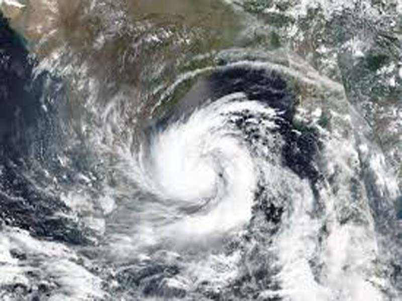
Persistent cyclonic circulation across Telangana and Karnataka’s north interior: Met
AMARAVATI (ANDHRA PRADESH), AUG 18 : Saturday’s cyclonic circulation over North Interior Karnataka & adjoining Telangana persists and is now seen to extend upto 4.5 km above mean sea level, tilting southwestward with height, the Meteorological Centre said on Sunday.
In a daily weather report here, it said that Saturday’s trough runs from above cyclonic circulation over North Interior Karnataka and adjoining Telangana to the Southeast Arabian Sea across Kerala, extending up to 1.5 km above mean sea level.
The southwest monsoon is normal over coastal Andhra Pradesh, Yanam, and Rayalaseema.
Heavy rain is likely to occur at isolated places in North Coastal Andhra Pradesh & Yanam during the next 48 hours and in Rayalaseema during the next 24 hours.
Thunderstorms accompanied by lightning and strong surface winds with speeds ranging from 30 to 40 Kmph are likely to occur at isolated places in North Coastal Andhra Pradesh & Yanam during the next five days and in Rayalaseema during the next 48 hours.
Strong surface winds with speeds ranging from 30 to 40 kmph are likely to occur at isolated places in South Coastal Andhra Pradesh during the next five days and in Rayalaseema from August 20–22.
Light to moderate rain or thundershowers is likely to occur at a few places or at isolated places in North Coastal Andhra Pradesh & Yanam, South Coastal Andhra Pradesh, and Rayalaseema during the next seven days.
Heavy rainfall occurred at Komarada (Parvathipuram Manyam District) in North Coastal Andhra Pradesh and Markapur (Prakasam District) in South Coastal Andhra Pradesh during the last 24 hours.
Rainfall occurred at one or two places over Coastal Andhra Pradesh & Yanam and at a few places over Rayalaseema, during the same period, the report added.(UNI)