Met Issues ‘Red Alert’ for Telangana, CS asks Collectors to be on high alert
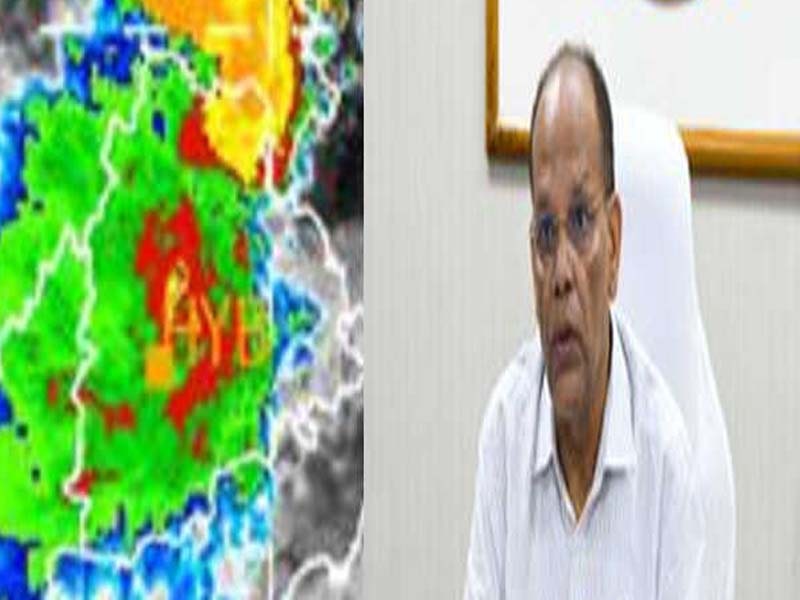
Hyderabad, July 10 : With Meteorological Centre here has issued a ‘Red Alert’ on Sunday afternoon for eight districts in Telangana, Chief Secretary Somesh Kumar directed all the District collectors to be on high alert and take all steps to prevent loss of life, cattle or damage to any property due to heavy rains which continue to batter the state.
On the directions of Chief Minister K Chandrashekar Rao, the Chief Secretary held a video conference with the Collectors of all districts and took stock of the situation arising due to heavy rains in the state over the last three days.
He directed the Collectors to work in close coordination with all the line departments and take all preventive measures and see that no untoward incident takes place.
Met, while issuing a ‘Red Alert’ to 8 districts said ‘Heavy to Very Heavy with Extremely Heavy rainfall’ is very likely to occur at isolated places in Adilabad, Komaram Bheem Asifabad, Mancherial, Nirmal, Nizamabad, Jagtial, Peddapalli and Jayashankar Bhupalpally districts till 0830 hours on Monday.
Somesh Kumar said that as the state is witnessing heavy rains over the last three days the Collectors should be on high alert and take all steps to prevent loss of life, cattle or damage to any property.
He directed the Collectors to step up vigil by setting up control room in the Collectorate. Irrigation, Panchayat Raj, Municipal Administration and Energy departments should ensure that no problems arise due to the incessant rains.
As the tanks, ponds and reservoirs are in spate, officials should be on high alert and see that sand bags are kept ready if breaches to vulnerable tanks takes place, the Chief Secretary said.
People living in low lying areas may be shifted to special camps if necessary.
Any damages to roads should be immediately repaired, he added.
Met also issued an ‘Orange Alert’ forecasting Heavy to Very Heavy rain is very likely to occur at isolated places in Rajanna Sircilla, Karimnagar, Mulugu, Bhadradri Kothagudem, Khammam, Nalgonda, Suryapet, Mahabubabad, Warangal (Rural),Warangal (Urban) and Jangaon districts.
Heavy rain is very likely to occur at isolated places in Siddipet, Yadadri Bhuvangiri, Rangareddy, Vikarabad, Sangareddy, Medak and Kamareddy districts of Telangana during the same period, Met said while issuing an ‘Yellow Alert’.
It said there will be water logging in many parts of low-lying areas in that districts of Telangana and disruption of rail/road transport in the few areas of the districts for many hours.
Forecast for Hyderabad city:
There will be generally cloudy sky. Light to moderate rain or thundershowers, at times heavy intense spells is very likely to occur in the city.
Kotapally Mandal in Mancherial district received a heavy rainfall of 158.5 millimeters followed by Mutharam Mahadevpur in Jayashankar district 130 mm, Mahadevpur in Jayashankar district 125 mm and Kotapally in Mancherial district 124 mm from 0830 hours to 1300 hours today.
Meanwhile, in a Special Weather Bulletin, Met centre said the Low Pressure Area over south interior Odisha & neighbourhood now lies over coastal areas of South Odisha North Andhra Pradesh & neighbourhood with the associated cyclonic circulation extending upto 7.6 km above mean sea level tilting southwestwards with height.
The monsoon trough now passes through Bikaner, Sikar, Shivpuri, Satna, Jharsuguda, centre of Low Pressure Area over coastal areas of south Odisha North Andhra Pradesh & neighbourhood and thence southeastwards to Eastcentral Bay of Bengal and extends upto 1.5 km above mean sea level.
The eastwest shear zone now runs roughly along 20°N tilting southwestwards with height between 3.1 km & 5.8 km above mean sea level across North Peninsular India.(UNI)